
Area guidesChiswick
Chiswick
W4 · Hounslow
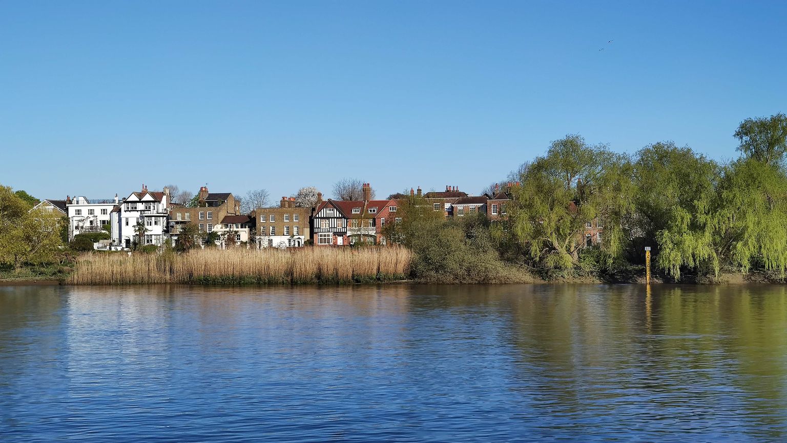
Chiswick Mall from the Thames at Chiswick Eyot. Photograph by James Emmans.
Chiswick sits on a bend of the Thames in the London Borough of Hounslow, a leafy, Georgian-and-Victorian stretch of west London where the high street runs down almost to the water and rowing eights slide past on the tide. It has drawn writers, painters and now television actors for three centuries, and still feels like a village that happens to sit inside a global city.
What stands out
- A genuinely riverside identity: the Thames path, Chiswick Eyot and the finish of the Boat Race at Chiswick Bridge set it apart from inland west London.
- An unbroken creative pedigree, from Hogarth and Pope through Van Gogh and Yeats to the actors and musicians who live here now.
- A high street that still feels local, with independent shops, pavement cafes and markets that have run on the same spot for generations.
Trade-offs
- The housing stock leans toward larger period houses, mansion blocks and converted warehouse space rather than the newer, more varied stock found elsewhere in the borough.
- The Great West Road and the High Road itself carry heavy through-traffic, and that severance is more noticeable here than in quieter pockets nearby.
- The riverside charm has a seasonal downside: stretches of the towpath and Chiswick Eyot are exposed to tidal flooding, worth checking before assuming easy river access year-round.
Things to know about Chiswick
- Actors Colin Firth, David Tennant, Catherine Zeta-Jones, Timothy Dalton and Elizabeth McGovern have all lived in Chiswick, part of a long list of performers and musicians linked to the area.
- Fuller, Smith & Turner has brewed at the riverside Griffin Brewery on the same site for more than 350 years.
- A young Vincent van Gogh spent three years in 1870s Chiswick teaching Sunday school, a detail that surprises most people who only know his later painting.
- The Boat Race finishes at Chiswick Bridge, with Duke's Meadows one of its best-known viewpoints, and the Chiswick reach is home to several rowing clubs.
- Chiswick has some of west London's oldest surviving pubs, including the 1880s Tabard with its William Morris interior.
Life here
- Chiswick High Road mixes independent shops, restaurants and cafes, many with pavement seating, running down toward the river.
- A Sunday farmers' market is held at Duke's Meadows, alongside a monthly flower market, an antiques market and a 'Cheese and Provisions' market on the High Road near the old market place by the Hogarth statue.
- The area holds an annual book festival.
- The Tabard Theatre, above the Tabard pub, stages new writing and experimental work.
- Historic pubs including the Mawson Arms, the George and Devonshire, the Old Packhorse and riverside pubs at Strand-on-the-Green are still trading.
- The Thames towpath and a cluster of rowing clubs, including the University of London Boat Club, Quintin Boat Club and Tideway Scullers School, make the river a working part of local life, alongside rugby, cricket and a multi-sport centre on Chiswick Common.
History and what it is known for
- Chiswick was first recorded around the year 1000 as the Old English 'Ceswican', meaning Cheese Farm, and the riverside Duke's Meadows is thought to have hosted an annual cheese fair into the 18th century.
- The area was settled in Roman times, with Roman coins found at Turnham Green and Roman brickwork found under the Sutton manor house.
- A decisive Civil War skirmish took place at Turnham Green in November 1642, when a larger Parliamentarian force under the Earl of Essex halted royalist troops under Prince Rupert marching on London, who retreated and never threatened the capital again.
- The Dukes of Devonshire owned Chiswick House from 1758 to 1929, leaving their legacy in many of the area's street names.
- The Royal Horticultural Society's first garden and school of horticulture were sited in Chiswick from 1822 until the lease ended in 1904, when the Society's Wisley garden was established.
- Bedford Park, on the Chiswick and Acton border, was laid out from 1875 and is generally regarded as the first garden suburb.
Notable connections
- William Hogarth — painter and satirist, bought the house now known as Hogarth's House in 1749, lived there until his death in 1764, and is buried at St Nicholas's churchyard
- Alexander Pope — poet, lived in Chiswick between 1716 and 1719 in the building now known as the Mawson Arms
- Vincent van Gogh — later a celebrated painter, lived in Chiswick for three years in the 1870s teaching Sunday school
- W. B. Yeats — poet, lived in Chiswick as a boy from 1879 and returned in 1887; Chiswick Eyot is said to have inspired his poem The Lake Isle of Innisfree
- E. M. Forster — novelist, lived in Chiswick from 1939 until at least 1961
- John Entwistle and Pete Townshend — of the rock band The Who, both born in Chiswick during the Second World War
On screen
- Patrick — 2018 film shot in Chiswick; the only screen production currently confirmed in our sources, so treat this as a starting point rather than a complete list
Background from Chiswick on Wikipedia (CC BY-SA 4.0) and Wikidata (CC0), summarised for this guide. Details change — check anything that matters to you.
Everyday life
A Saturday in Chiswick tends to orbit the High Road: a coffee or breakfast among the cafes and pavement seating, a browse of the shops, and a wander down toward the river. The old market place near the Hogarth statue still hosts a rotating cast of stalls through the month, alongside a Sunday farmers' market by Duke's Meadows, so there is usually some kind of market on somewhere in the area.
Evenings run to the area's historic pubs, several of them listed buildings, including the Mawson Arms, the George and Devonshire, the Old Packhorse and the Tabard, plus a run of riverside pubs at Strand-on-the-Green. For something more organised there is the Tabard Theatre for new writing above the pub of the same name, and an annual book festival.
The Thames itself is a big part of local life: the towpath for walking and cycling, and a cluster of rowing clubs on the Chiswick reach whose crews train past Chiswick Eyot and Duke's Meadows. Rugby, cricket and a multi-sport centre on Chiswick Common round out the weekend options for anyone who wants to join in rather than just watch.
Housing character
Chiswick's building stock reflects its long, staggered growth: Georgian survivals around the old village at St Nicholas Church, dense Victorian terraces from the area's tenfold population growth in the nineteenth century, and Edwardian streets further out. Bedford Park, on the Chiswick and Acton border, is usually described as the first garden suburb, and its distinctive houses are part of that legacy.
Riverside living here takes some unusual forms, from mansion blocks and houseboats moored along the Mall to warehouse and office conversions further inland, a pattern that started when former industrial and warehouse buildings began turning into offices and, later, homes. Anyone drawn to that riverside character should look closely at exactly which stretch of frontage a property sits on, since the Mall, Strand-on-the-Green and the newer developments each have a different feel.
Getting around
Chiswick is served by the District line, with Turnham Green and Chiswick Park both in the area and Gunnersbury nearby giving an interchange with the Overground. The High Road and the Great West Road provide the main road links, though the latter also brings the through-traffic noted above.
The riverside towpath is a genuine walking and cycling route rather than just a view, running along the Mall and past Chiswick Eyot toward Kew in one direction and Hammersmith in the other, and it is worth factoring into how car-dependent day-to-day life here actually is.
Things to investigate
Our evidence for Chiswick is built on the W4 postcode district as a proxy boundary, not an approved neighbourhood polygon, and it carries a borough-level house-price figure for Hounslow rather than a neighbourhood one; treat any figure a reader sees alongside this guide with that in mind. There is no connected rent series, no journey-time data and no licensed venue register behind this text, so specifics on any of those should be checked directly.
Anyone with children should check current admission arrangements directly with each school's own admission authority rather than relying on distance from a chosen address. Anyone drawn to the riverside stretches, in particular Chiswick Eyot and parts of the Mall, should check current flood-risk designations with the Environment Agency and the council before assuming untroubled access to the water year-round.
Schools
Measured by distance from the area centre, straight line. Primary is a walk and secondary is a journey, so they are counted on different radii. Ofsted's published judgements, not a Greathome rating.
Primarystate-funded, within 2 km
14 schools
- Judged by Ofsted
- 12
- At least Good
- 12
- Outstanding or equivalent
- 4
- Below Good
- 0
Secondarystate-funded, within 5 km
23 schools
- Judged by Ofsted
- 22
- At least Good
- 22
- Outstanding or equivalent
- 12
- Below Good
- 0
29 open schools of every phase sit within 2 km, 10 of them independent. Independent schools carry no Ofsted judgement in this release, so they appear in the total and never in the judged figures. Nothing here establishes catchment, admissions eligibility or available places.
The nearest 6 schools, with their published judgement
| School | Phase | Distance | Published judgement |
|---|---|---|---|
| Belmont Primary School | Primary | 0.1 km | Expected standard · Report card, curriculum and teaching |
| Heathfield House School | Not applicable | 0.5 km | No published judgement |
| St Mary's Catholic Primary School ,Chiswick | Primary | 0.6 km | Good · Overall effectiveness, pre-September 2024 |
| The William Hogarth Primary School | Primary | 0.7 km | Good · Overall effectiveness, pre-September 2024 |
| ArtsEd Day School & Sixth Form | Not applicable | 0.8 km | No published judgement |
| Southfield Primary School | Primary | 1 km | Outstanding · Overall effectiveness, pre-September 2024 |
Housing market context
£512,888average house price across Hounslow, June 2026
A year earlier the same measure was £507,076, a change of +1.1%.
Average price across the whole local authority for one month, from the ONS series built on HM Land Registry UK House Price Index data. It is not a neighbourhood median and not a valuation of any property. Two guides in the same borough share this figure while their streets differ. House-price data is revised, and recent months are the most likely to move.
Source: Average house price by local authority, Office for National Statistics, from HM Land Registry UK House Price Index.
Boundary
Chiswick, taken as the W4 postcode district. A postcode-district proxy, not an approved polygon. These are postcode districts standing in for an approved polygon. Present every count as "in these postcode districts", never as a neighbourhood or town-centre figure.
Sources
- Average house price by local authority — Office for National Statistics, from HM Land Registry UK House Price Index
- Get Information About Schools — Department for Education
- Ofsted inspection management information — Ofsted
- Street-level crime data — Police.uk
- Postcode and administrative geography — Postcodes.io / ONS
Evidence checked 2026-09-13. Last content change 2026-09-13. Next review 2026-09-20.
Geography and local records
Local records load separately while you read the guide.
What this report does not cover
- neighbourhood median sale price (not_available): Only a local-authority average is connected, from ONS. A neighbourhood median needs enough geocoded transactions inside the guide boundary, which the per-postcode HMLR queries cannot supply.
- rents (not_available): No rent series is connected. Advertised rents and official all-tenancy measures are different things and neither is available here yet.
- journey times (not_available): No journey planner is connected. Transport is measured as nearby stops, not as time to anywhere. TfL PTAL and journey-time APIs would replace it for London.
- school admissions history (not_available): Admission arrangements are held by each admission authority and are not in the GIAS or Ofsted snapshots.
- licensed premises and venues (not_available): No licensing register or venue dataset is connected. Food-hygiene categories are not a pub register.
- image rights (not_yet_verified): No licensed image library is connected. Return an image brief rather than an asset.
- approved boundary polygon (not_yet_verified): Boundaries are postcode-district proxies. Counts describe the districts named, not a town-centre polygon.