
Area guidesCroydon
Croydon
CR0 · Croydon, London
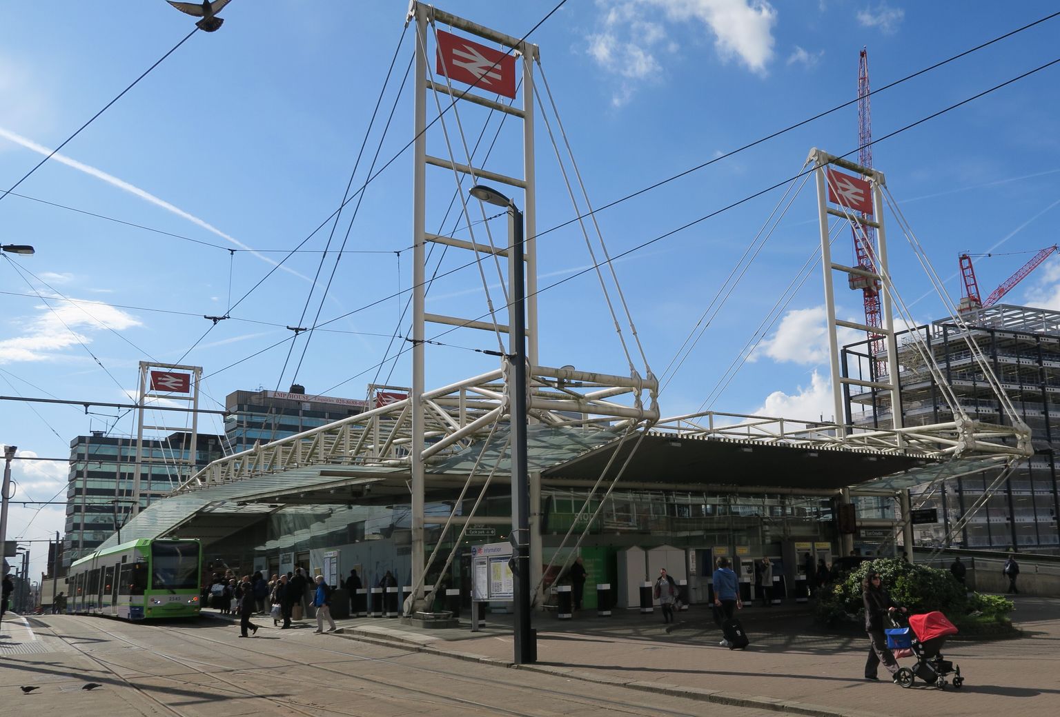
A tram outside East Croydon station. Photograph by Hzh.
Croydon is Greater London's biggest bet on itself: a historic market and archbishops' town that reinvented itself as a 1960s office boomtown, and is still reinventing itself now. The guide below covers the CR0 postcode district, which is one of London's largest and stretches well past the tower blocks around East Croydon station into quieter suburban streets — so treat this as an introduction to a wide district rather than a single neighbourhood.
What stands out
- A genuine cultural engine room: the BRIT School has sent a run of major British musicians into the world, Croydon's record shops helped invent dubstep, and the town centre has repeatedly doubled for other places on screen, from Gotham City to a Channel 4 sitcom's fictional world.
- Scale and ambition rare outside central London — a skyline of tall towers, a large retail core, and decades of regeneration plans (Westfield, Ruskin Square, a rebuilt Fairfield Halls) that have alternately stalled and delivered.
- Real green space and a real river on the doorstep: the woods and commons around Croydon hold a large share of London's woodland, and the town centre sits near one of the sources of the chalk-stream River Wandle.
Trade-offs
- The postcode district is large and varied, so 'Croydon' can mean a high-rise flat minutes from East Croydon station or a leafy street well out towards the district's edge — the character changes a great deal within CR0.
- Big regeneration promises here have a mixed track record: schemes such as the Westfield redevelopment and a new arena have been announced, delayed, revived and in some cases abandoned over more than a decade.
- The town centre's 1960s and 1970s rebuild left a legacy of large office blocks, multi-storey car parks, an underpass and a flyover that some newcomers find harder to love than the original Victorian and Georgian streets they replaced.
Things to know about Croydon
- Stormzy was born in Croydon, and the town's BRIT School in Selhurst has produced Adele, Amy Winehouse, Leona Lewis and Katie Melua, among others.
- Peep Show was set and filmed around Croydon for over a decade, and the Delta Point building near West Croydon station played Gotham General Hospital in The Dark Knight Rises.
- Netflix's Heartstopper actor Kit Connor was born and raised in Croydon.
- Croydon was at the centre of dubstep's development, with DJs Benga and Skream cutting their teeth at a Surrey Street record shop.
- Croydon was the site of London's main airport until the Second World War, a striking history for a town now known for its office towers rather than runways.
Life here
- The Fairfield Halls complex (concert hall, the Ashcroft Theatre and the Arnhem Gallery) reopened in 2019 after refurbishment and remains the town's main arts venue, home to the London Mozart Players.
- The Croydon Clocktower building houses a library, the Museum of Croydon and the independent David Lean Cinema.
- About 60 murals were added to the town centre in 2018 as part of the Rise street art festival, coordinated by the Rise gallery in Croydon.
- Surrey Street Market has long been a focus of town-centre trading, and record shops such as Reggaemasters and Addiscombe's DnR Vinyl continue a local tradition of dubstep and vinyl retail.
- Crystal Palace Football Club plays at Selhurst Park in the borough, and woods including Lloyd Park and Croham Hurst give the district a large share of Greater London's woodland.
History and what it is known for
- Croydon's name is first recorded in a Saxon chronicle of 809 as 'Crogeden'; it appears in the Domesday Book of 1086 as 'Croindene', held by Archbishop Lanfranc.
- For centuries Croydon was the hub of an estate belonging to the Archbishops of Canterbury, whose manor house stood in the area still called Old Town; six Archbishops of Canterbury are buried in the parish church, now Croydon Minster.
- Archbishop Robert Kilwardby obtained a market charter for Croydon in 1276, marking the town's foundation as an urban centre.
- The Whitgift Almshouses, built between 1596 and 1599 by Archbishop John Whitgift for the 'poor, needy and impotent', still stand in the town centre and were saved from demolition by the House of Lords in 1923.
- The parish church was largely destroyed by fire in 1867 and rebuilt by the Victorian architect Sir George Gilbert Scott, reopening in 1870.
- Croydon was London's main airport until it was superseded by Heathrow after the Second World War, finally closing in 1959; central Croydon was heavily damaged by V-1 and V-2 attacks during the war.
Notable connections
- Stormzy — UK grime and rap artist, born in Croydon.
- Kit Connor — Actor known for Heartstopper on Netflix, born and raised in Croydon.
- Peggy Ashcroft — Actress, born in Croydon and attended Croydon High School; the Ashcroft Theatre at Fairfield Halls is named after her.
- Samuel Coleridge-Taylor — Composer, grew up in Croydon and lived in Selhurst until his death in 1912; commemorated at the Museum of Croydon.
- Amy Winehouse — Singer-songwriter, attended the BRIT School in Croydon.
- Tracey Emin — Artist, born in Croydon.
On screen
- Peep Show — Channel 4 sitcom (2003–2015) set in and frequently filmed around Croydon.
- The Dark Knight Rises — The Delta Point building near West Croydon station appeared as Gotham General Hospital.
- Black Mirror: Bandersnatch — 2018 interactive film with scenes shot at St George's Walk and No.1 Croydon.
- The Bill — ITV police drama set in fictional East London but filmed around Surrey Street and St George's House in Croydon.
- Terry and June — Sitcom whose opening credits showed the stars walking around the Whitgift Centre and Fairfield Halls.
Background from Croydon on Wikipedia (CC BY-SA 4.0) and Wikidata (CC0), summarised for this guide. Details change — check anything that matters to you.
Everyday life
Central Croydon runs on a mix of long-established shopping streets and newer additions: the Whitgift Centre and Centrale sit alongside independent stalls on Surrey Street, which has hosted a market for centuries, and street art added to the town centre through the Rise festival gives some of the back streets a very different feel from the shopping malls a few minutes away. The Fairfield Halls complex — concert hall, theatre, gallery and cinema under one roof — reopened after refurbishment and remains the obvious anchor for an evening out, alongside the Clocktower building's library, museum and independent David Lean Cinema.
Away from the centre, the district fans out into distinct suburban areas each with their own high streets, churches and clubs, from sports grounds used by long-running rugby and hockey clubs to smaller theatres and comedy nights. Crystal Palace FC's Selhurst Park gives the borough a Premier League focal point on matchdays, and the woods, commons and parks — including Lloyd Park and Croham Hurst — offer walking routes that feel a long way from the tower blocks near the station.
Housing character
Housing character shifts sharply across the district: new-build apartment towers cluster tightly around East Croydon station and the office core, some of them among the tallest residential buildings in the country, while streets further out hold Victorian and Edwardian terraces, interwar semis and the more spacious roads towards the district's leafier southern edges. Newcomers drawn by a flat near the station should expect a very different day-to-day setting from those looking at a house further from the centre.
Getting around
Croydon's rail links into central London are a long-standing draw, and the Croydon Tramlink network, running since 2000, connects the town centre to surrounding suburbs and neighbouring boroughs. The town centre itself was reshaped for cars in the mid-20th century, leaving an underpass and flyover that some find unwelcoming on foot, though large areas including North End have since been pedestrianised.
Things to investigate
Ask what stage any current regeneration scheme has actually reached: plans covering the Whitgift Centre site, Croydon Gateway and other major developments have moved on very different timelines, with some delayed for years and others abandoned outright. It's also worth checking which part of the CR0 district a specific street sits in, since the postcode covers a wide area, and treating any Croydon-wide description as applying equally to a flat by the station and a house on the district's outer edge is a common newcomer mistake.
Schools
No school evidence was returned for this area centre.
Boundary
Croydon, taken as the CR0 postcode district. CR0 is one of the largest postcode districts in London and reaches well beyond the town centre, so counts cover the district rather than central Croydon. These are postcode districts standing in for an approved polygon. Present every count as "in these postcode districts", never as a neighbourhood or town-centre figure.
Sources
- Average house price by local authority — Office for National Statistics, from HM Land Registry UK House Price Index
- Get Information About Schools — Department for Education
- Ofsted inspection management information — Ofsted
- Street-level crime data — Police.uk
- Postcode and administrative geography — Postcodes.io / ONS
Evidence checked 2026-09-13. Last content change 2026-09-13. Next review 2026-09-20.
Geography and local records
Local records load separately while you read the guide.
What this report does not cover
- neighbourhood median sale price (not_available): Only a local-authority average is connected, from ONS. A neighbourhood median needs enough geocoded transactions inside the guide boundary, which the per-postcode HMLR queries cannot supply.
- rents (not_available): No rent series is connected. Advertised rents and official all-tenancy measures are different things and neither is available here yet.
- journey times (not_available): No journey planner is connected. Transport is measured as nearby stops, not as time to anywhere. TfL PTAL and journey-time APIs would replace it for London.
- school admissions history (not_available): Admission arrangements are held by each admission authority and are not in the GIAS or Ofsted snapshots.
- licensed premises and venues (not_available): No licensing register or venue dataset is connected. Food-hygiene categories are not a pub register.
- image rights (not_yet_verified): No licensed image library is connected. Return an image brief rather than an asset.
- approved boundary polygon (not_yet_verified): Boundaries are postcode-district proxies. Counts describe the districts named, not a town-centre polygon.