
Area guidesMaidenhead
Maidenhead
SL6 · Windsor and Maidenhead
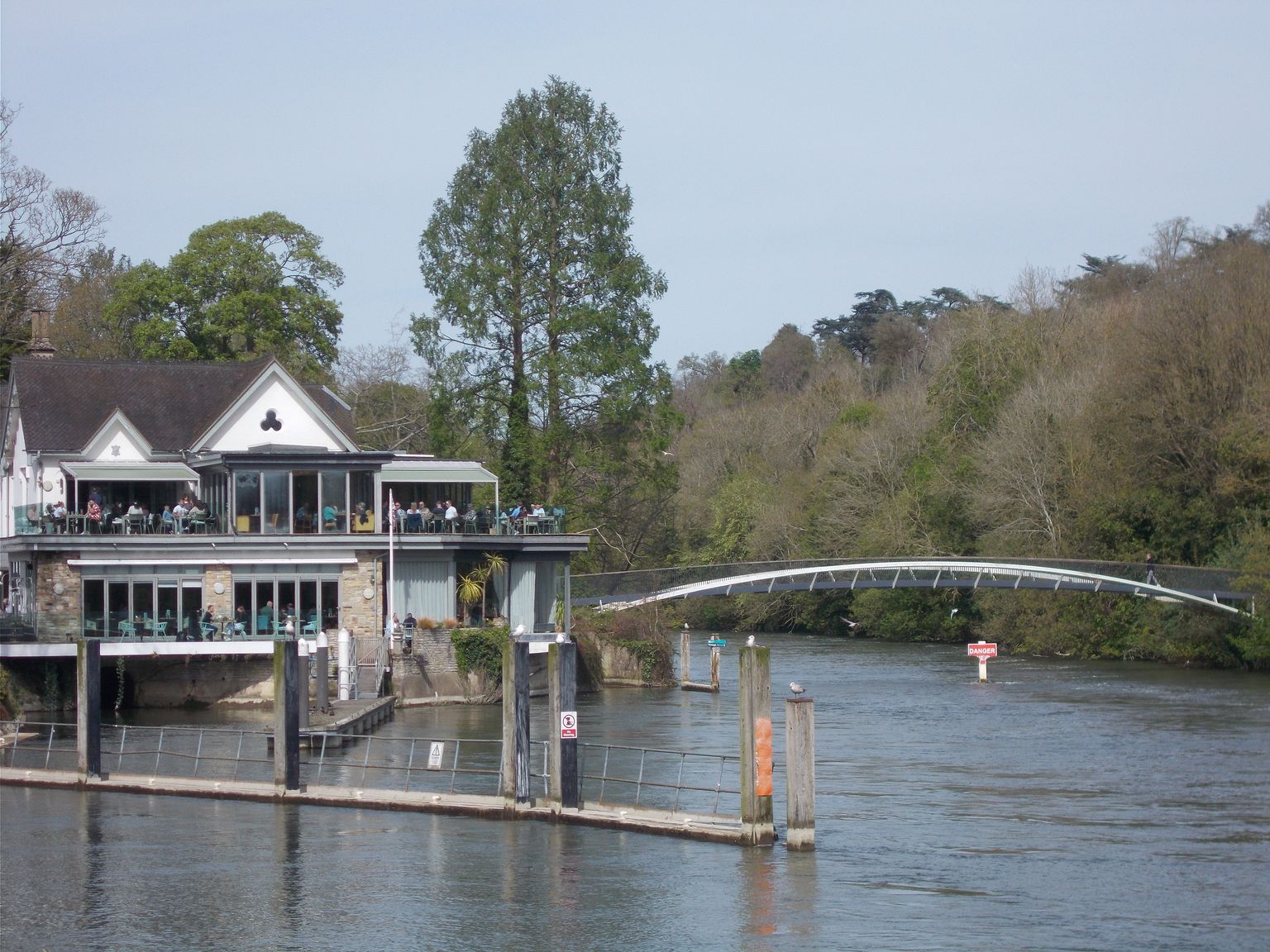
Boulter's Lock on the Thames at Maidenhead. Photograph by Peter S.
Maidenhead sits on a bend of the Thames on the western edge of Greater London's commuter belt, in the Royal Borough of Windsor and Maidenhead. It pairs a working river-town identity - rowing clubs, lock-side walks, a regatta season - with a town centre that has been substantially rebuilt around modern offices and company headquarters. This guide covers the SL6 postcode district, used here as a proxy for the town centre rather than the wider borough.
What stands out
- A genuine river town: Boulter's Lock, Ray Mill Island and the Maidenhead Regatta give the Thames a real presence in daily life, not just a backdrop.
- A business and commuter hub on the old 'Silicon Corridor', with head offices - including the Commonwealth War Graves Commission - close to the railway station, which now sits on the Elizabeth line as well as the Great Western main line.
- A long sporting pedigree: Maidenhead United's York Road ground is one of the oldest football grounds in the world in continuous use by the same club, alongside an active rugby club and rowing scene.
Trade-offs
- The historic centre has been heavily redeveloped: a widely cited 2005 assessment questioned how much traditional market-town character survives on the High Street, and regeneration has been a long-running project rather than a finished one.
- The town centre's mix of offices and modern apartment blocks can feel more corporate than picturesque next to neighbouring Thames towns such as Marlow or Henley.
- Because redevelopment has proceeded piecemeal over decades, parts of the centre can still feel mid-transition rather than settled.
Things to know about Maidenhead
- The Spice Girls shared a house in Maidenhead for a year before their rise to stardom.
- Maidenhead United play at York Road, the oldest football ground in the world continuously used by the same team.
- Sir Nicholas Winton, commemorated with a statue at Maidenhead railway station, rescued 669 Jewish children from Czechoslovakia at the outbreak of World War II.
- Doctor Dolittle creator Hugh Lofting was born in Maidenhead.
- The town is a rowing centre on the River Thames, home to the Maidenhead Regatta alongside the Marlow and Henley regattas.
Life here
- Maidenhead is a rowing town on the River Thames, with Maidenhead Rowing Club organising the Maidenhead Regatta, an event often seen as a testing ground for Olympic rowing athletes.
- Maidenhead United play at York Road, and the Maidenhead Rugby Club, founded in 1921, is the largest organised sports team in the town, with four men's teams, a women's team and a youth programme.
- The Maidenhead Citadel Band of the Salvation Army has performed in the town since 1886.
- The head office of the Commonwealth War Graves Commission is based in Maidenhead, and multinational companies such as Johnson & Johnson also have offices in the town.
- The local newspaper is the Maidenhead Advertiser.
- Boulter's Lock, on the Thames at the edge of the town, and Ray Mill Island remain a well-known part of Maidenhead's riverside.
History and what it is known for
- The town's name comes from a Saxon wharf, 'Maiden Hythe', built on the Thames.
- In 870 an army of Danes landed at Maidenhead and fought its way to Reading, where they set up a regional base.
- The settlement appears in the Domesday Book as Ellington, in the hundred of Beynhurst.
- A new bridge built around 1280 diverted the Great West Road through the town, and the settlement became known as Maidenhythe.
- By the mid-18th century Maidenhead was one of the busiest coaching towns, with over ninety coaches a day passing through; the Bear Hotel survives on the High Street from that era.
- King Charles I met his children for the last time before his execution in 1649 at the Greyhound Inn on the High Street, now the site of a NatWest Bank branch.
Notable connections
- Hugh Lofting — born in Maidenhead; created Doctor Dolittle
- Sir Nicholas Winton — lived at nearby Pinkneys Green; rescued 669 Jewish children from Czechoslovakia before World War II
- Diana Dors — actress who lived for much of her life in the town
- Richard Dimbleby — broadcaster who lived for a time on Boulter's Island
- The Spice Girls — shared a house in Maidenhead for a year before their rise to stardom
- Roy and John Boulting — film director brothers born in Bray village on the outskirts of Maidenhead
Background from Maidenhead on Wikipedia (CC BY-SA 4.0) and Wikidata (CC0), summarised for this guide. Details change — check anything that matters to you.
Everyday life
Life here centres on the river and the town's sporting clubs: rowing around Boulter's Lock and Ray Mill Island, the Maidenhead Regatta each summer, and a large rugby club with men's, women's and youth sides. Maidenhead United's home games at York Road and a long-running Salvation Army Citadel Band add to a town with strong club and community traditions.
The High Street and Bridge Street form the everyday retail core, though much of the original streetscape was rebuilt in the postwar decades, so the centre reads as a working commuter and office town as much as a historic market town.
Corporate life is visible too: national and multinational employers, including the Commonwealth War Graves Commission's head office, sit within walking distance of the shops and the station.
Housing character
Housing character varies from the redeveloped centre - apartments and offices around the High Street and Bridge Street - to leafier Victorian-era streets that grew up once the Great Western Railway reached the town, and on to surrounding villages such as Cox Green, Pinkneys Green and Bray.
Very little of the medieval or Georgian town survives; the Bear Hotel and the Chapel Arches area hold some of the few older buildings left after decades of piecemeal redevelopment.
Riverside stretches near Boulter's Lock and Ray Mill Island carry a different, more villagey feel than the commercial centre, worth walking before judging the town by its High Street alone.
Getting around
Maidenhead's railway station is a stop on the Elizabeth line as well as the Great Western main line, giving direct rail links toward central London and out towards Reading and the west.
The A4 runs through the town, crossing the Thames on Maidenhead Bridge, reflecting the town's long history as a coaching and road-travel stop.
The river itself is used recreationally rather than for commuting, with towpaths and lock-side walks connecting the town toward Cookham, Bray and Windsor.
Things to investigate
Only a Windsor and Maidenhead borough-wide house-price series is connected here, not a neighbourhood figure, so treat any headline price as borough context, not a description of a particular street.
No rent series, journey-time data or licensed-venue register is connected, so verify current rental costs, actual commute times and the local pub and restaurant scene directly before relying on this guide for those.
School counts here are deduplicated establishment totals for the SL6 postcode district; phase counts overlap (an all-through school counts in both primary and secondary), and neither ownership type nor Ofsted outcome data establishes admissions eligibility - check the relevant admission authority directly.
Schools
No school evidence was returned for this area centre.
Housing market context
£576,992average house price across Windsor and Maidenhead, June 2026
A year earlier the same measure was £589,810, a change of -2.2%.
Average price across the whole local authority for one month, from the ONS series built on HM Land Registry UK House Price Index data. It is not a neighbourhood median and not a valuation of any property. Two guides in the same borough share this figure while their streets differ. House-price data is revised, and recent months are the most likely to move.
Source: Average house price by local authority, Office for National Statistics, from HM Land Registry UK House Price Index.
Boundary
The SL6 postcode district, used as a proxy for the town centre. It is a fraction of the wider Windsor and Maidenhead area and is not an administrative boundary. These are postcode districts standing in for an approved polygon. Present every count as "in these postcode districts", never as a neighbourhood or town-centre figure.
Sources
- Average house price by local authority — Office for National Statistics, from HM Land Registry UK House Price Index
- Get Information About Schools — Department for Education
- Ofsted inspection management information — Ofsted
- Street-level crime data — Police.uk
- Postcode and administrative geography — Postcodes.io / ONS
Evidence checked 2026-09-13. Last content change 2026-09-13. Next review 2026-09-20.
What is already known about Maidenhead
Geography from the official record. A district or place name is a group of postcodes, not one address.
- Live postcodes
- 2,316 in SL6
- Localities
- Belmont, Bisham, Cookham, Boyn Hill
- Local authority
- Buckinghamshire, Slough, Windsor and Maidenhead
- Country
- England
- Centre postcode
- SL6 6AJ
The pin uses Postcodes.io coordinates, not an exact entrance or title boundary.
Nearby pubs
Pubs mapped in OpenStreetMap within 2.0 miles of SL6 6AJ, nearest first.
Loading nearby pubs…
Place data from OpenStreetMap, available under the Open Database Licence (ODbL). © OpenStreetMap contributors
Look this place up in detail
Each of these opens on SL6 6AJ, the postcode anchoring Maidenhead, and queries its own source only when you open it.
Geography and local records
Local records load separately while you read the guide.
What this report does not cover
- neighbourhood median sale price (not_available): Only a local-authority average is connected, from ONS. A neighbourhood median needs enough geocoded transactions inside the guide boundary, which the per-postcode HMLR queries cannot supply.
- rents (not_available): No rent series is connected. Advertised rents and official all-tenancy measures are different things and neither is available here yet.
- journey times (not_available): No journey planner is connected. Transport is measured as nearby stops, not as time to anywhere. TfL PTAL and journey-time APIs would replace it for London.
- school admissions history (not_available): Admission arrangements are held by each admission authority and are not in the GIAS or Ofsted snapshots.
- licensed premises and venues (not_available): No licensing register or venue dataset is connected. Food-hygiene categories are not a pub register.
- image rights (not_yet_verified): No licensed image library is connected. Return an image brief rather than an asset.
- approved boundary polygon (not_yet_verified): Boundaries are postcode-district proxies. Counts describe the districts named, not a town-centre polygon.