
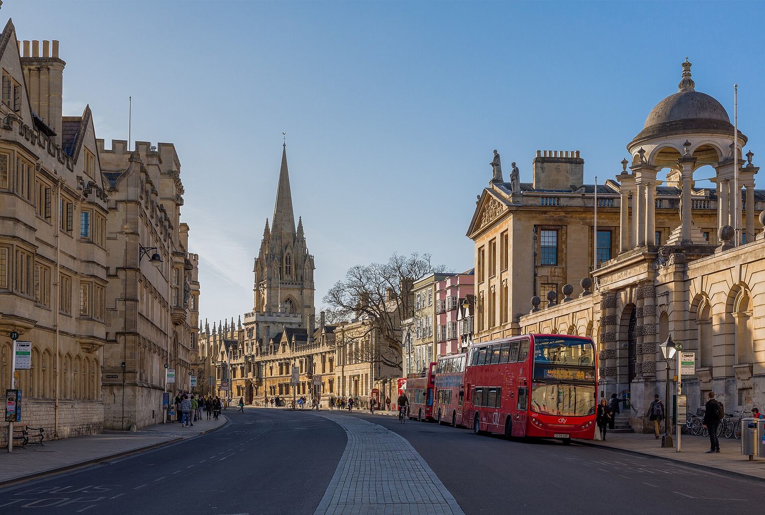
Oxford is a historic university city in southern England, known for its prestigious educational institutions and stunning architecture, offering a unique blend of academic and cultural attractions.
What stands out
- Picturesque college buildings
- Bustling market squares
- Scenic river walks
Trade-offs
- Quaint narrow streets versus busy shopping areas
- Academic quiet versus lively festival atmosphere
- High-end boutiques versus quirky second-hand shops
Everyday life
Residents can enjoy a range of daily amenities, from grocery shopping on bustling high streets to relaxing in beautiful parks and gardens, and taking advantage of various cultural events and exhibitions throughout the year.
Housing character
The area features a diverse range of properties, from elegant period homes and converted townhouses to modern apartments and student accommodations, offering something for different tastes and lifestyles.
Getting around
The city centre is relatively compact, making it easy to walk or cycle around, with several main roads, such as the A40 and Woodstock Road, providing access to surrounding areas, and a railway station with regular services to nearby cities.
Things to investigate
Visitors and residents may want to explore the city's many museums, libraries, and galleries, including the famous Bodleian Library, take a stroll along the River Cherwell, or attend one of the many festivals and events that take place throughout the year, such as the Oxford Literary Festival.
Schools
Measured by distance from the area centre, straight line. Primary is a walk and secondary is a journey, so they are counted on different radii. Ofsted's published judgements, not a Greathome rating.
Primarystate-funded, within 2 km
8 schools
- Judged by Ofsted
- 7
- At least Good
- 7
- Outstanding or equivalent
- 0
- Below Good
- 0
Secondarystate-funded, within 5 km
4 schools
- Judged by Ofsted
- 4
- At least Good
- 4
- Outstanding or equivalent
- 1
- Below Good
- 0
18 open schools of every phase sit within 2 km, 5 of them independent. Independent schools carry no Ofsted judgement in this release, so they appear in the total and never in the judged figures. Nothing here establishes catchment, admissions eligibility or available places.
The nearest 6 schools, with their published judgement
| School | Phase | Distance | Published judgement |
|---|---|---|---|
| Christ Church Cathedral School | Not applicable | 0.3 km | No published judgement |
| The Eckersley School of English | Not applicable | 0.3 km | No published judgement |
| Activate Learning | 16 plus | 0.6 km | No published judgement |
| New College School | Not applicable | 0.6 km | No published judgement |
| University of Oxford | Not applicable | 0.7 km | No published judgement |
| St Ebbe's Church of England Aided Primary School | Primary | 0.8 km | School remains Good · Ungraded inspection |
Housing market context
£466,815average house price across Oxford, June 2026
A year earlier the same measure was £470,992, a change of -0.9%.
Average price across the whole local authority for one month, from the ONS series built on HM Land Registry UK House Price Index data. It is not a neighbourhood median and not a valuation of any property. Two guides in the same borough share this figure while their streets differ. House-price data is revised, and recent months are the most likely to move.
Source: Average house price by local authority, Office for National Statistics, from HM Land Registry UK House Price Index.
What this report does not cover
- neighbourhood median sale price (not_available): Only a local-authority average is connected, from ONS. A neighbourhood median needs enough geocoded transactions inside the guide boundary, which the per-postcode HMLR queries cannot supply.
- rents (not_available): No rent series is connected. Advertised rents and official all-tenancy measures are different things and neither is available here yet.
- journey times (not_available): No journey planner is connected. Transport is measured as nearby stops, not as time to anywhere. TfL PTAL and journey-time APIs would replace it for London.
- school admissions history (not_available): Admission arrangements are held by each admission authority and are not in the GIAS or Ofsted snapshots.
- licensed premises and venues (not_available): No licensing register or venue dataset is connected. Food-hygiene categories are not a pub register.
- image rights (not_yet_verified): No licensed image library is connected. Return an image brief rather than an asset.
- approved boundary polygon (not_yet_verified): Boundaries are postcode-district proxies. Counts describe the districts named, not a town-centre polygon.
Boundary
Oxford, taken as the OX1 postcode district. A postcode-district proxy, not an approved polygon. These are postcode districts standing in for an approved polygon. Present every count as "in these postcode districts", never as a neighbourhood or town-centre figure.
Sources
- Average house price by local authority — Office for National Statistics, from HM Land Registry UK House Price Index
- Get Information About Schools — Department for Education
- Ofsted inspection management information — Ofsted
- Street-level crime data — Police.uk
- Postcode and administrative geography — Postcodes.io / ONS
Evidence checked 2026-09-11. Last content change 2026-09-11. Next review 2026-09-18.
What is already known about Oxford
Geography from the official record. A district or place name is a group of postcodes, not one address.
- Live postcodes
- 847 in OX1
- Localities
- Botley, Sunningwell, Carfax, Jericho
- Local authority
- Oxford, Vale of White Horse
- Country
- England
- Centre postcode
- OX1 4NG
The pin uses Postcodes.io coordinates, not an exact entrance or title boundary.
Tiles © OpenStreetMap contributors
Districts next to OX1
Found in the same 2.8 km sample around the centre of OX1, from 205 live postcodes. Proximity, not a boundary.
Nearby pubs
Pubs mapped in OpenStreetMap within 2.0 miles of OX1 4DS, nearest first.
Loading nearby pubs…
Place data from OpenStreetMap, available under the Open Database Licence (ODbL). © OpenStreetMap contributors
Look this place up in detail
Each of these opens on OX1 4DS, the postcode anchoring Oxford, and queries its own source only when you open it.
Geography and local records
Local records load separately while you read the guide.