
Area guidesFulham
Fulham
SW6 · Hammersmith and Fulham
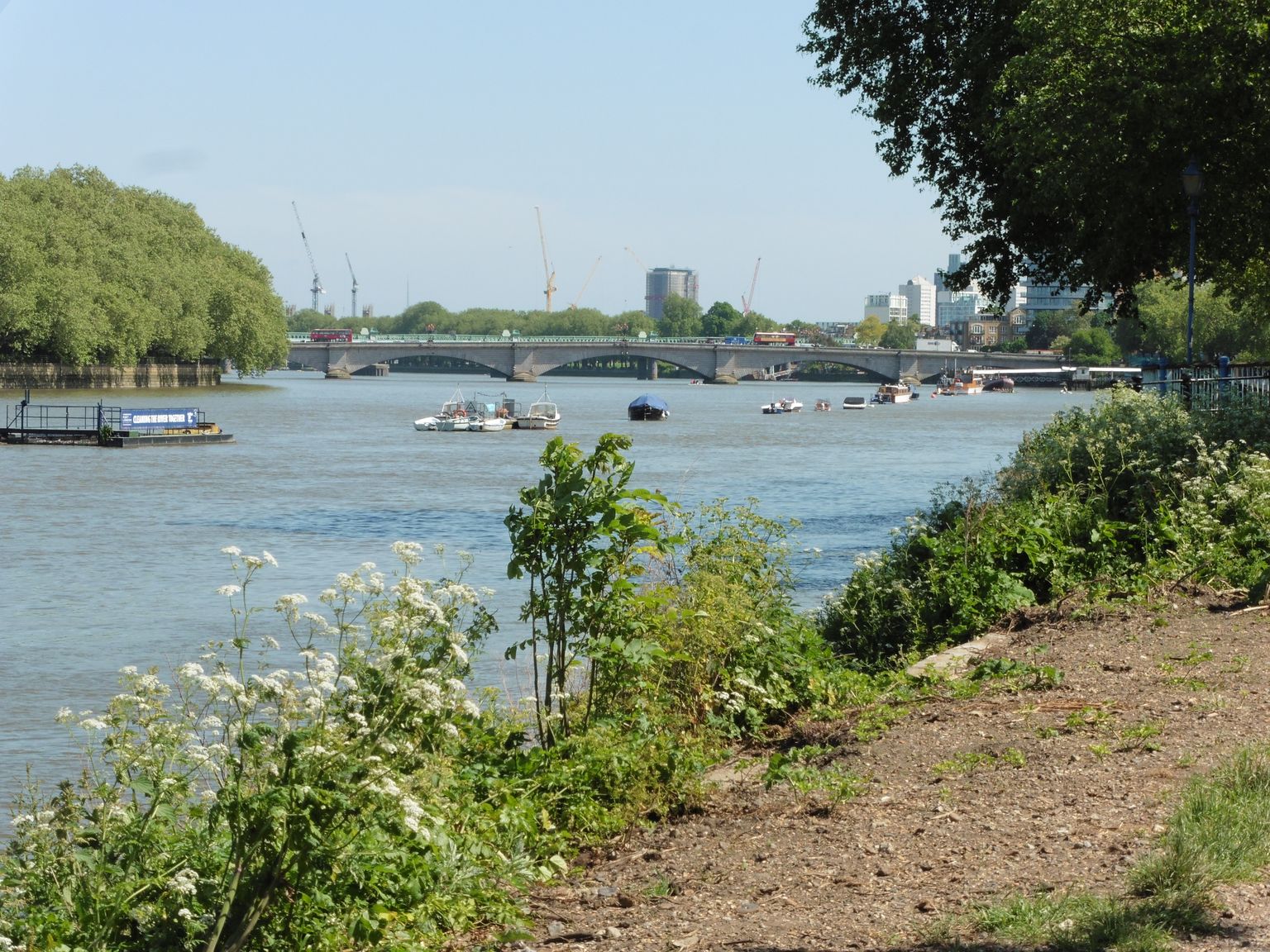
The Thames Path near Craven Cottage, looking to Putney Bridge. Photograph by Dave Kelly.
Fulham sits in a loop of the Thames in south-west London; the guide here is drawn for the SW6 postcode district rather than the whole London Borough of Hammersmith and Fulham. It is a place of red-brick Victorian terraces, riverside parks and a genuinely village-like high street around Fulham Broadway and Parsons Green, all within easy reach of central London.
What stands out
- A continuous riverside walk along the Thames Path through Bishop's Park and past the Fulham Pier extension towards Hammersmith, running alongside the grounds of Fulham Palace.
- Sporting life runs deep here: Fulham FC's Craven Cottage and Chelsea FC's Stamford Bridge both trace back to the same Victorian sporting ground at Lillie Bridge, and Hurlingham Park still hosts the annual Polo in the Park tournament.
- A high street with two centres rather than one: the pedestrianised old village heart behind Fulham Broadway, and the market and shops along North End Road.
Trade-offs
- Fulham's popularity has driven considerable gentrification since the late twentieth century, and its Victorian housing stock and location now put it firmly among London's sought-after addresses, which is worth weighing against budget before falling for the area.
- Redevelopment pressure has closed some long-standing local institutions in recent years, including historic pubs near the borough boundary, so what's open today is not guaranteed to stay that way.
- Large-scale redevelopment at the eastern edge of the area, tied to the former Earl's Court exhibition site, has meant ongoing demolition and construction disruption that anyone considering that part of Fulham should check on before committing.
Things to know about Fulham
- BBC television presenter Jill Dando lived in Fulham from 1994 until her murder there in 1999.
- Actor Daniel Radcliffe comes from Fulham.
- Hans Zimmer, double Oscar winner, launched his career in a studio behind the Lillie Langtry public house in Lillie Road in the 1970s.
- Fulham FC's Craven Cottage and Chelsea FC's Stamford Bridge both trace back to the same Victorian sporting ground at Lillie Bridge.
- Fulham Palace was the country residence of the Bishops of London for centuries, and Sands End holds the reputedly oldest surviving gasholder in the World.
Life here
- The Thames riverside walk in Bishop's Park is now continuous past the Fulham Pier extension towards Hammersmith Bridge, past the Crabtree pub and The River Cafe.
- Hurlingham Park hosts the annual Polo in the Park tournament, and the Hurlingham Club remains the historic home of polo in the United Kingdom.
- Fulham has five active Bowls clubs: The Bishops Park Bowls club, The Hurlingham Park Bowls Club, Normand Park Bowls Club, The Parson's Green Bowls club and The Winnington in Bishops Park.
- The pedestrianised heart of old Walham Green, behind Fulham Broadway, is bordered by cafes, bars and a dance studio in the old Fulham Public Baths.
- The performing arts continue in Fulham through the Fulham Symphony Orchestra and the Fulham Opera, with St John's Parish Church staging choral and instrumental concerts.
- North End Road remains Fulham's unofficial high street and still has a street market.
History and what it is known for
- The name Fulham comes from Old English, Fulla's hemmed-in land, and is spelt Fuleham in the 1066 Domesday Book.
- Excavations near Fulham Palace have revealed Neolithic riverside settlement and Roman activity during the third and fourth centuries AD.
- Fulham Palace was the country residence of the Bishops of London for a millennium, with the manor said to have been granted to Bishop Erkenwald around the year 691 or acquired by Bishop Waldhere in AD 704.
- In 1824 the Imperial Gas Light and Coke Company, the first public utility company in the World, bought the Sandford estate in Sands End, and its number 2 gasholder, completed in 1830, is reputed to be the oldest gasholder in the World.
- The first organised sporting activity in Fulham took place at the Lillie Bridge Grounds in the 1860s, introducing British Amateur Athletics and the first codified Boxing under Marquess of Queensberry Rules; after a riot destroyed the Grounds in 1889, Fulham F.C.'s Craven Cottage and Chelsea F.C.'s Stamford Bridge replaced them.
- Fulham has undergone significant gentrification since the late 20th century, and by the 2000s had established itself as one of London's most desirable Zone 2 neighbourhoods.
Notable connections
- Daniel Radcliffe — actor, comes from Fulham
- Jill Dando — BBC television presenter, lived in Fulham from 1994 until her murder there in 1999
- Hans Zimmer — double Oscar winner, launched his career in a studio behind the Lillie Langtry public house in Lillie Road in the 1970s
- Linford Christie — Olympian athlete who attended Henry Compton School
- Geoffrey de Havilland — aviation pioneer, built his first aeroplane at his workshop in Fulham in 1909
- Janet Street-Porter — journalist who grew up in Fulham
Background from Fulham on Wikipedia (CC BY-SA 4.0) and Wikidata (CC0), summarised for this guide. Details change — check anything that matters to you.
Everyday life
Life in Fulham tends to orbit two hubs: the pedestrianised old heart of Walham Green behind Fulham Broadway, with its cafes, bars and a dance studio housed in the former public baths, and North End Road, still home to a working street market. Riverside days are easy to imagine, following the Thames Path through Bishop's Park and on past the Fulham Pier extension towards Hammersmith. Sport and community life are unusually intertwined: several bowls clubs operate across the area's parks, Hurlingham Park draws crowds for its Polo in the Park tournament, and the Fulham Symphony Orchestra and Fulham Opera keep live performance going alongside concerts at St John's Parish Church.
Housing character
The housing here reflects a long run of Victorian and Edwardian development on what was, into the twentieth century, still a largely working-class area of market gardens and industry. Genteel pockets grew up early around North End, Parsons Green, Eel Brook Common, South Park and the Hurlingham Club, and it was this Victorian terraced stock, together with the riverside setting, that drew the professionals and families who reshaped Fulham's character from the late twentieth century onwards. The result today is a mix of grander houses near the river and Hurlingham, closely-packed terraces further from the water, and flatted and newer riverside development around Chelsea Harbour and Imperial Wharf.
Getting around
Fulham is served by the District line, with stations including Putney Bridge, Parsons Green and Fulham Broadway, and by the West London Line through West Brompton and Imperial Wharf. Its position in the loop of the Thames means bridges matter for how the area connects outward, notably Putney Bridge to the south-west, with routes north towards Hammersmith and Chelsea. The Thames Path itself is a genuine local amenity for walking and cycling rather than just a scenic route, running the length of the riverside from Bishop's Park onward.
Things to investigate
Ask what has changed recently rather than relying on an older description of the area: pubs and small businesses near the borough boundary have closed under redevelopment pressure in the past decade, and the long-running redevelopment on the site of the former Earl's Court exhibition centres, on Fulham's eastern edge, continues to reshape that end of the area with ongoing demolition and construction. It is also worth checking which stretch of Fulham a listing actually sits in: the character changes noticeably between the riverside around Hurlingham and Bishop's Park, the shopping streets around Fulham Broadway and Parsons Green, and the area around North End Road and West Kensington to the north.
Schools
Measured by distance from the area centre, straight line. Primary is a walk and secondary is a journey, so they are counted on different radii. Ofsted's published judgements, not a Greathome rating.
Primarystate-funded, within 2 km
21 schools
- Judged by Ofsted
- 21
- At least Good
- 20
- Outstanding or equivalent
- 3
- Below Good
- 1
Secondarystate-funded, within 5 km
26 schools
- Judged by Ofsted
- 26
- At least Good
- 26
- Outstanding or equivalent
- 10
- Below Good
- 0
37 open schools of every phase sit within 2 km, 8 of them independent. Independent schools carry no Ofsted judgement in this release, so they appear in the total and never in the judged figures. Nothing here establishes catchment, admissions eligibility or available places.
The nearest 6 schools, with their published judgement
| School | Phase | Distance | Published judgement |
|---|---|---|---|
| All Saints CofE Primary School | Primary | 0.2 km | School remains Good · Ungraded inspection |
| Burlington House School | Not applicable | 0.2 km | No published judgement |
| Parsons Green Prep School | Not applicable | 0.3 km | No published judgement |
| Thomas's Academy | Primary | 0.4 km | School remains Good · Ungraded inspection |
| St John's Walham Green Church of England Primary School | Primary | 0.6 km | Outstanding · Overall effectiveness, pre-September 2024 |
| Ormiston Bridge Academy | Not applicable | 0.7 km | Good · Overall effectiveness, pre-September 2024 |
Housing market context
£725,562average house price across Hammersmith and Fulham, June 2026
A year earlier the same measure was £836,877, a change of -13.3%.
Average price across the whole local authority for one month, from the ONS series built on HM Land Registry UK House Price Index data. It is not a neighbourhood median and not a valuation of any property. Two guides in the same borough share this figure while their streets differ. House-price data is revised, and recent months are the most likely to move.
Source: Average house price by local authority, Office for National Statistics, from HM Land Registry UK House Price Index.
Boundary
Fulham, taken as the SW6 postcode district. A postcode-district proxy, not an approved polygon. These are postcode districts standing in for an approved polygon. Present every count as "in these postcode districts", never as a neighbourhood or town-centre figure.
Sources
- Average house price by local authority — Office for National Statistics, from HM Land Registry UK House Price Index
- Get Information About Schools — Department for Education
- Ofsted inspection management information — Ofsted
- Street-level crime data — Police.uk
- Postcode and administrative geography — Postcodes.io / ONS
Evidence checked 2026-09-13. Last content change 2026-09-13. Next review 2026-09-20.
What is already known about Fulham
Geography from the official record. A district or place name is a group of postcodes, not one address.
- Live postcodes
- 1,506 in SW6
- Localities
- Fulham Reach, Fulham Town, Lillie, Munster
- Local authority
- Hammersmith and Fulham
- Country
- England
- Centre postcode
- SW6 4HL
The pin uses Postcodes.io coordinates, not an exact entrance or title boundary.
Districts next to SW6
Found in the same 2.8 km sample around the centre of SW6, from 225 live postcodes. Proximity, not a boundary.
- SW10Sands End · Chelsea Riverside · Redcliffe39 postcodes in the sample
- SW18Thamesfield · St Mary's29 postcodes in the sample
- SW15Thamesfield25 postcodes in the sample
- W6Fulham Reach25 postcodes in the sample
- SW11St Mary's17 postcodes in the sample
- SW5Earl's Court17 postcodes in the sample
- W14West Kensington · Avonmore · Abingdon8 postcodes in the sample
Nearby pubs
Pubs mapped in OpenStreetMap within 2.0 miles of SW6 5JJ, nearest first.
Loading nearby pubs…
Place data from OpenStreetMap, available under the Open Database Licence (ODbL). © OpenStreetMap contributors
Look this place up in detail
Each of these opens on SW6 5JJ, the postcode anchoring Fulham, and queries its own source only when you open it.
Geography and local records
Local records load separately while you read the guide.
What this report does not cover
- neighbourhood median sale price (not_available): Only a local-authority average is connected, from ONS. A neighbourhood median needs enough geocoded transactions inside the guide boundary, which the per-postcode HMLR queries cannot supply.
- rents (not_available): No rent series is connected. Advertised rents and official all-tenancy measures are different things and neither is available here yet.
- journey times (not_available): No journey planner is connected. Transport is measured as nearby stops, not as time to anywhere. TfL PTAL and journey-time APIs would replace it for London.
- school admissions history (not_available): Admission arrangements are held by each admission authority and are not in the GIAS or Ofsted snapshots.
- licensed premises and venues (not_available): No licensing register or venue dataset is connected. Food-hygiene categories are not a pub register.
- image rights (not_yet_verified): No licensed image library is connected. Return an image brief rather than an asset.
- approved boundary polygon (not_yet_verified): Boundaries are postcode-district proxies. Counts describe the districts named, not a town-centre polygon.